Nasty burst of wind expected as bomb low moves away from NSW coast
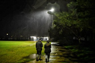
Coastal NSW from Sydney to the South Coast can expect a windy battering this evening as a deepening low-pressure system moves offshore, stirring winds that will likely gust to near-cyclonic strength in places.
The transient low, which has already brought late-season snow to parts of northern NSW and the Blue Mountains, will also have dumped about 80 millimetres of rain on Sydney as it moves through.

Strong winds and torrential rain at Newport on Tuesday. Credit:Nick Moir
If locked-down Sydneysiders hadn’t reason enough to stay indoors, the winds and rain have also kept “feels-like†temperatures in single digits all day Tuesday.
The Bureau of Meteorology has issued several warnings, including for damaging coastal winds and hazardous surf.
Winds could exceed 90 kilometres per hour later on Tuesday afternoon in a narrow coastal strip from Sydney down to the northern reaches of the South Coast. Wave heights there could up to six metres, bringing localised coastal erosion, the bureau said.
The deepening low will bring “a fairly nasty burst of windsâ€, Ben Domensino, a senior Weatherzone meteorologist, said. “We could see over 100-kilometre per hour winds.â€
The impact of the low, though, could have been worse. The fact the system will deepen offshore and move away quickly means it probably won’t meet the typical description of an east coast low, Mr Domensino said.
Still, it may match the criteria for a so-called bombogenesis or “weather bomb†if its core drops at least 24 hectopascals â€" a measure of pressure â€" within 24 hours.

Curfew or not, Tuesday night and into Wednesday morning might be good to be indoors especially if you live near the coast.Credit:Nick Moir
Wind strength should pick up by about 4pm in the Illawarra and South Coast regions, while Sydney’s coastal fringe will start to feel or more likely hear it a couple of hours later, Mr Domensino said.
“It’ll start backing off on Wednesday morning and there should be another surge during the day but it won’t be as strong,†he said.
The rain event snapped a fortnight or so of dry weather for Sydney including a record run of 15 winter days of at least 20 degrees. The two-day rainfall total is the most since the floods in March.
Before Tuesday’s dive in temperatures, the month-to-date maximums in Sydney were averaging 21.4 degrees, or 3.5 degrees above the long-run norm for Observatory Hill near the CBD.

Blackheath was blanketed by snow as the cold air moved across the Blue Mountains.Credit:Wolter Peeters
The city’s rain gauge had also only picked up 9 millimetres of rain before Tuesday’s soaking, or a fraction of the 80.2 millimetres for a typical August. July was relatively dry too, with a little over a third of Sydney’s usual July rainfall.
The low will move off into the Tasman and steer on-shore winds and some showers into the Sydney region for the next few days. By Sunday and early Monday, though, milder conditions should return with temperatures nudging back into the low to mid-20s.
The Morning Edition newsletter is our guide to the day’s most important and interesting stories, analysis and insights. Sign up here.
Peter Hannam writes on environment issues for The Sydney Morning Herald and The Age.

0 Response to "Nasty burst of wind expected as bomb low moves away from NSW coast"
Post a Comment